
This is a long, rambling personal reflection of Ken and my climb on Mount Wilson yesterday. Click here to skip straight to the climbing route beta section.
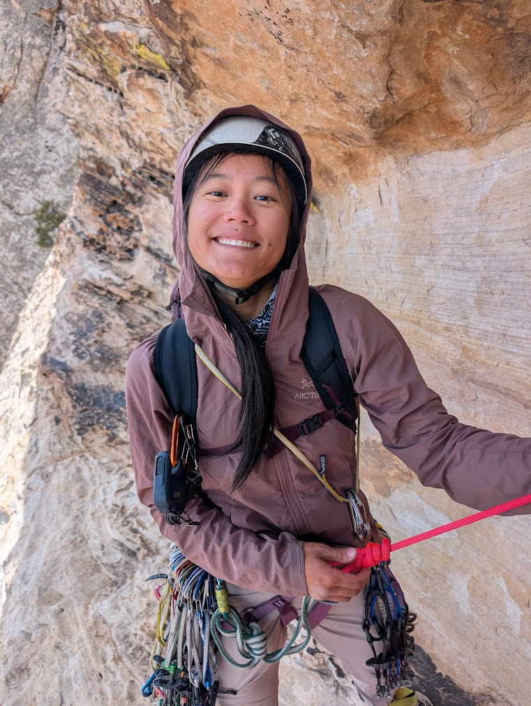
The Vegas climbing season is going well. I’ve been in town for almost a month now and am remembering how to climb with my bare fingers after the long ice season. I’ve been kept busy with work at The Mountain Guides. It’s been a joy to rock guide in this special place. Finding time for personal climbing has been hard as I get back into climbing shape, and juggle lots of life admin, and guide admin work, but yesterday, Ken and I had the pleasure of climbing Mount Wilson.
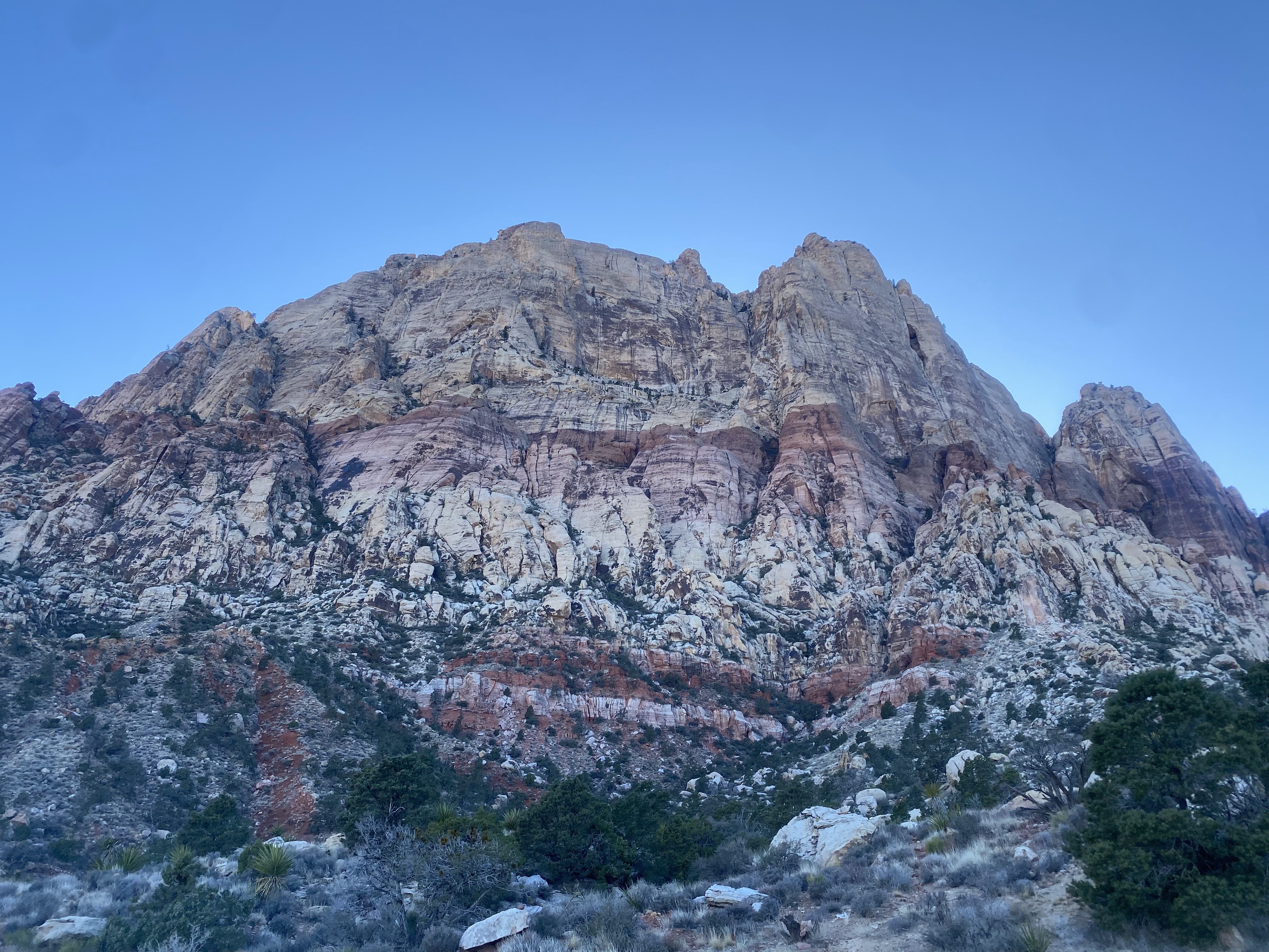
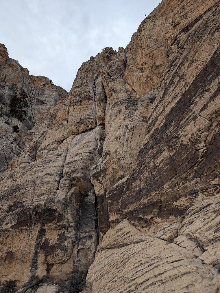
Mount Wilson is the tallest and largest mountain in Red Rocks, NV. All of the routes up the mountain are long, serious adventures: around 15-20 pitches of 5.9 to 5.11 climbing. Ken and I have been eyeing routes on the mountain this season, starting with Inti Watana, a 12 pitch 5.10c route of mixed sport climbing and trad climbing, which links up to the upper pitches of Resolution Arete, which has a more adventure alpine style.
First, here’s a personal report of our time on the route and below is a more objective climbing route beta. Beta we wished we’d had yesterday!
Personal Reflection
After having a few 12-15 hour days guiding Solar Slab this season, I felt ready, physically and mentally, for a long day out on rock. We left the car at 5:30am, and arrived at the base of the climb by 7:30am.
The first rays of sun hitting the White Rot gully were beautiful and welcome as we navigated the scramble. We both were full of gratitude to be out in this space adventuring together.
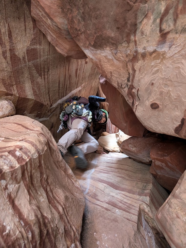
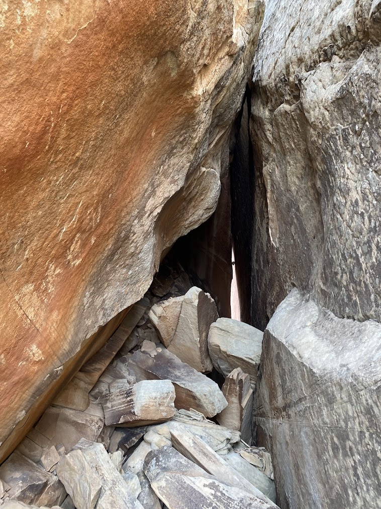
The approach was full-on. We had to scramble carefully on loose blocks and go under this huge chockstone (I think my post-college studio apartment was smaller than this chockstone).
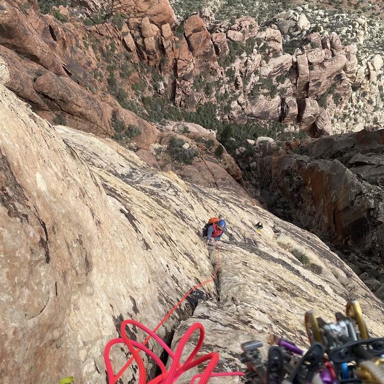
The first six pitches of the route flew by for me, probably because Ken was leading! I just focused on following as fast as I could, so we could keep up with our time plan. Once I took the sharp end, my brain snapped into focus, as it usually does when I start leading.
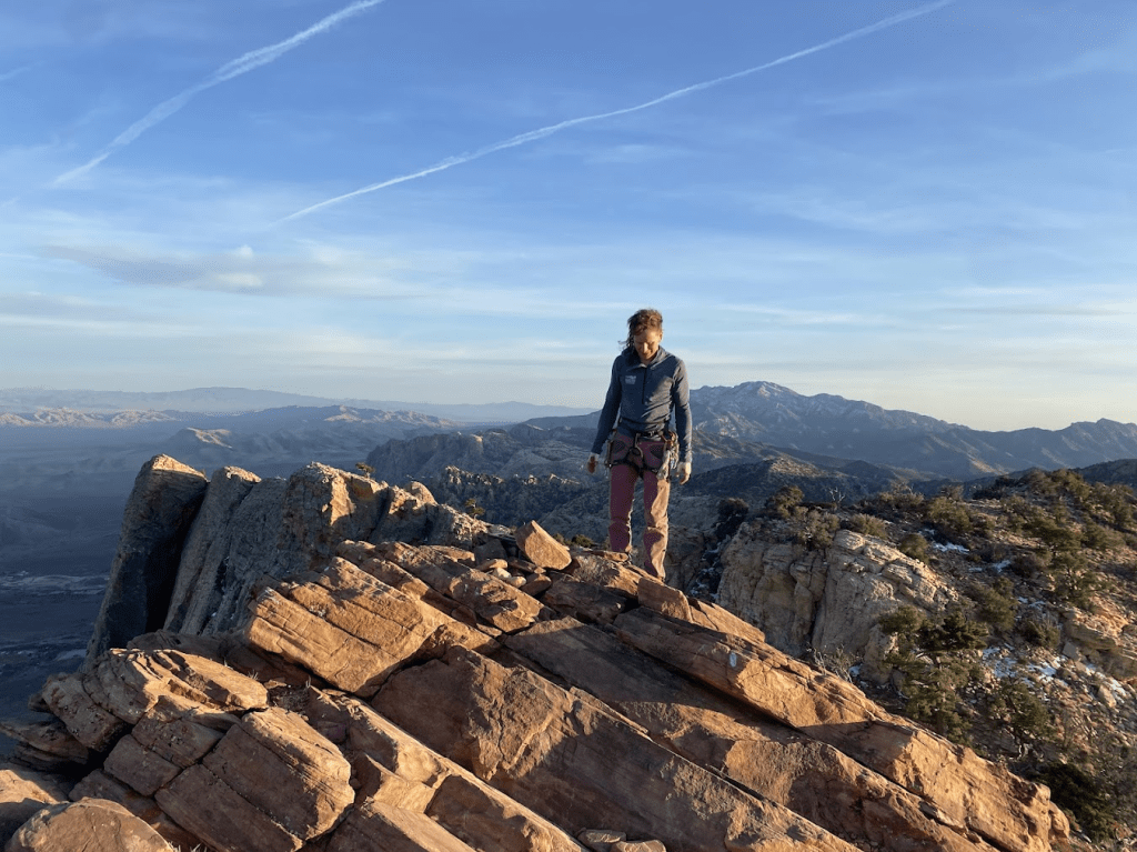
At the top of pitch 8, grinning because I led scary (for me!) slab.
This route was funny, because there were bolts next to perfectly good cracks (where one could place cams), but on harder slab moves, the bolts were out of reach. Rude.
All jokes aside, the face climbing on this route was stellar, and some of my favorite climbing on any multi-pitch I’ve done in Red Rocks so far. And it was all reasonably protected.
Pitch 8 also had a giant bivy ledge, where Ken and I want to come and spend the night sometime! We’d have to haul some big packs up the route, but the thought of watching the sunrise from halfway up the Aeolian wall, catching the first light on Mt. Wilson, would easily be worth it.
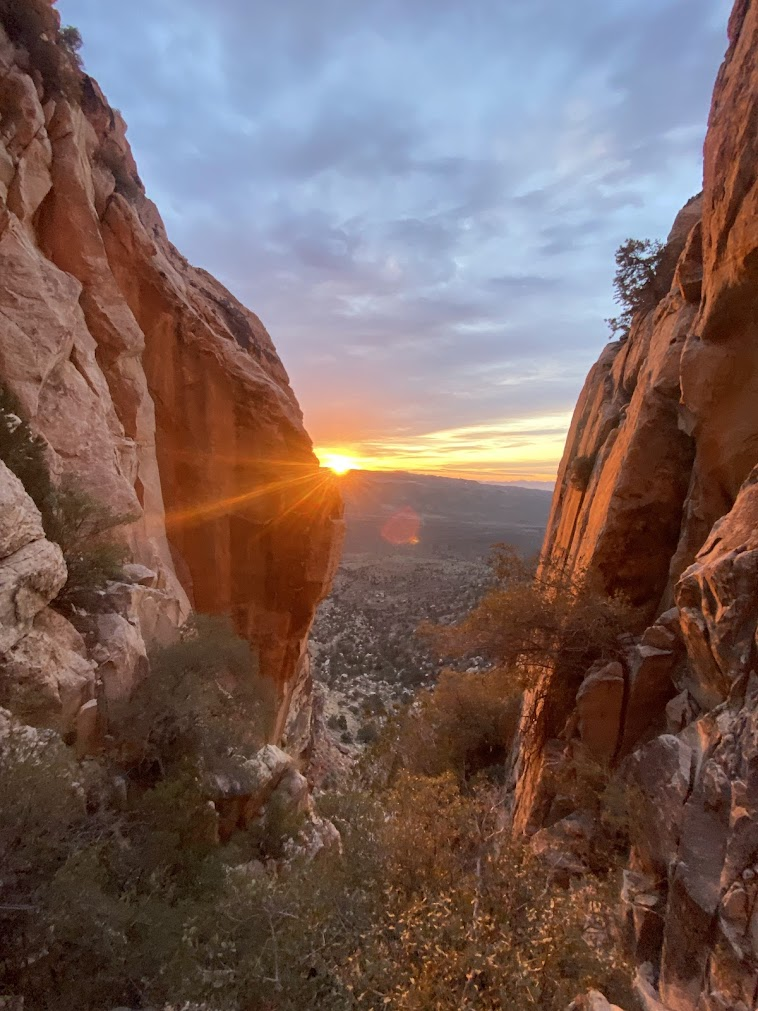
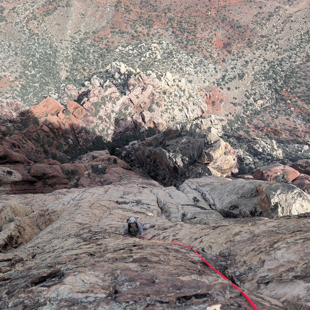
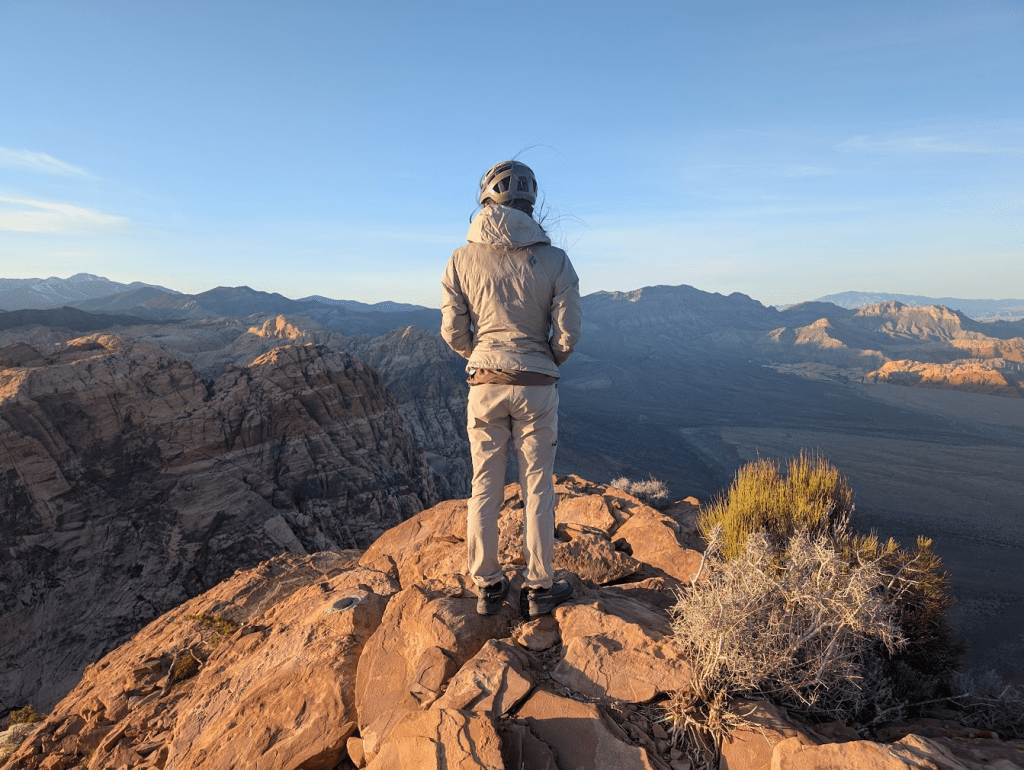
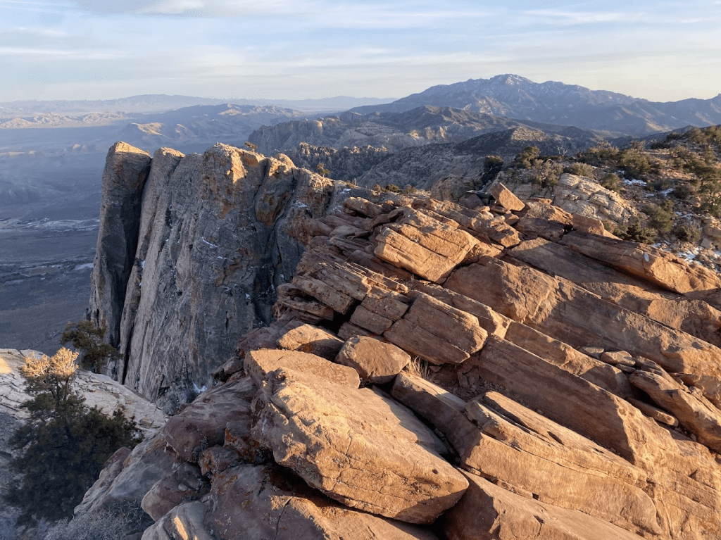
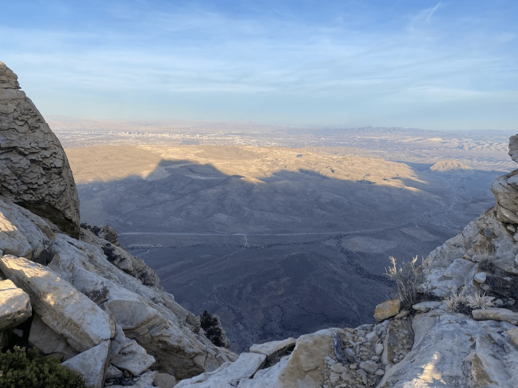
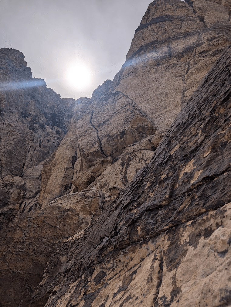
Climbing higher on the route had some incredible exposure. Some 1500 feet looking all the way down the route to the ground, views of the neighboring mountains, and all the way out to the Las Vegas strip.
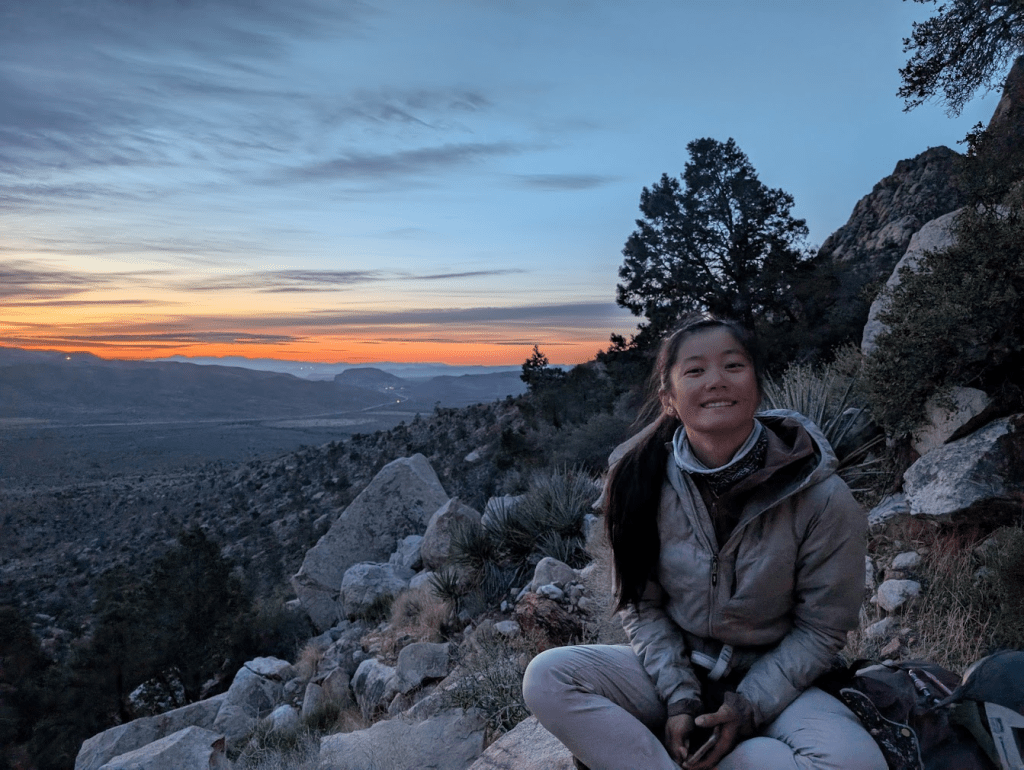
Once at the top of Inti, we were incredibly pleased to be right on our time plan, at 1:20pm. We had planned 3 hours to climb the rest of Resolution Arete to the summit, but hadn’t included a lunchtime break in this time plan. We spent 20 minutes un-roping and eating sandwiches at another great bivy site on the route, mentally preparing to get back to climbing.
Navigational Challenges
Then… we couldn’t figure out where to go. (There’s a full description of where we should have gone, below). We were cliffed out on 3 sides, looking up at a blank wall with no bolts. Looking back, I think we both were just struggling with the transition from the easy navigation on Inti (which is heavily bolted, easy navigation), to Resolution Arete, of which the upper part has no bolts, and some vague beta online.
We weren’t sure exactly what we were looking for, but I led up this roughly 5.4 scramble pitch, thinking that when I’d get to the top, I’d see something obvious. Ken was hesitant and warned me to not climb anything I didn’t want to downclimb. I brushed this aside, confident this was definitely the way to go. I scrambled to the top, looked around, and immediately felt frustration and some underlying panic. Where the heck do you go? I looked to the left, and saw a distant gap in the rocks, with light shining through, but definitely not big enough to fit through, and to the right, it cliffed out.
I yelled some four-letter words down to Ken, and accepted I would have to downclimb and we’d try something else. I was not excited to downclimb, and hadn’t really considered this would be an option.
I sang a dumb made-up song to myself about making stupid choices and living to regret them while carefully finding each foothold, and downclimbed the ~30 foot pitch. In retrospect, it was really not that bad. The singing helped.
We regrouped on the ledge, digging through mountain project comments we’d already read, looking a third and fourth time through images we’d saved with route beta. The dilemma was if we made the wrong navigational choice, we’d have to figure out how to either get down, or make a new adventure forging a new path to get back on route. Neither of these were appealing, approaching our 10th hour of climbing, with sunset a few hours ahead.
I decided to go back up the pitch I had led, and take a more critical look around. I looked, no joke, 5 feet farther than I had before, and instantly realized we could walk behind this big boulder, to the start of the next pitch. I belayed Ken up and we walked to our first pitch of Resolution Arete, and we finished the climb uneventfully. It ended up being a really fun alpine-feeling adventure route, reminiscent for me of my time up in Washington Pass, where I first learned alpine rock climbing.
The summit
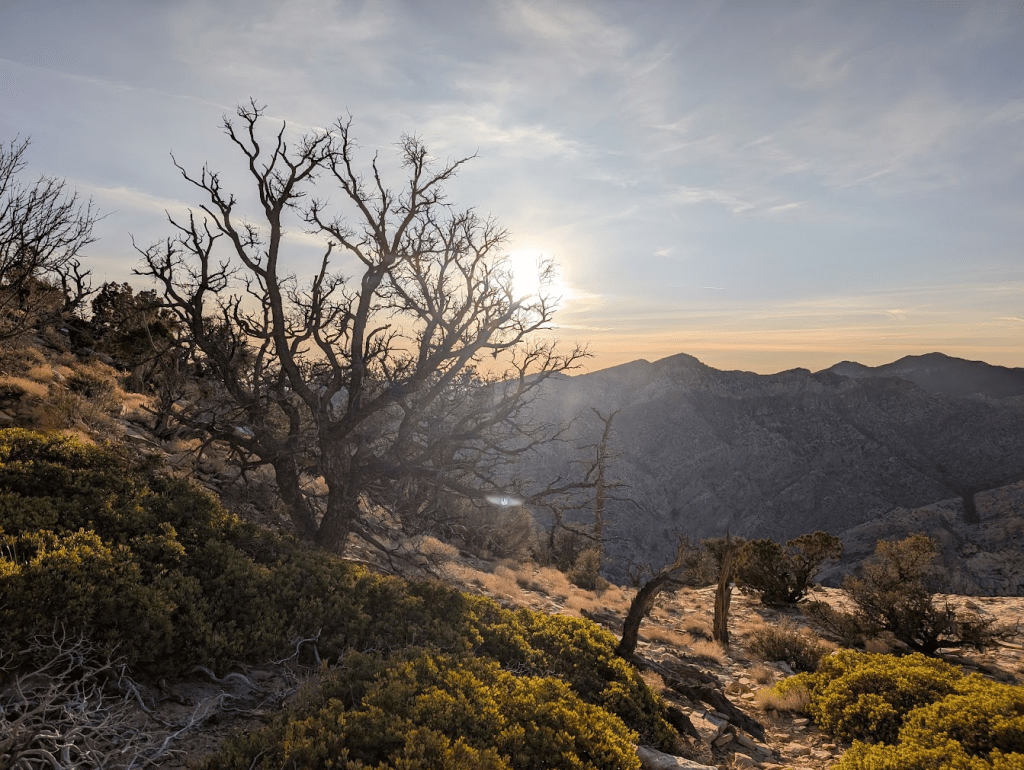
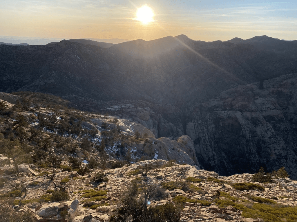
The summit was breathtaking, and worth every bit of scrambling, run-out off-width, missed sleep, and sore muscles. I didn’t even realize we had been climbing in the shade for hours, until I peered around the corner, and saw trees on the summit glowing in the warm evening light.
Wilson Slabs in the dark
The sunlight was long gone by the time we descended down to the Wilson gully, which has miles (okay not quite, but it felt like miles) of slab. In the dark, lit by headlamps, it was hard to see how far the slabs extended, or not. I found myself overwhelmed by the immensity of the terrain, imagining a cliff at the edge of the slab, where I would surely die if I let even one foot slip.
It was not nearly that bad. Low angle slabs, crab-walking and butt-scooting were very secure. These moments, where I’m nervous in terrain, give me even more empathy for my climbing guests, who are pushing their comfort zone, challenging their brains instinctive warnings that this is not safe with the cerebral understanding of rope systems, trust in their guide, their own movement and abilities, etc.
A couple weeks ago, I had a lovely guest open some lunchbox notes with me (the kind with the fold-out tab and a quote inside), and hers said “go as far as you can see. when you get there, you’ll see further” (J.P. Morgan). We laughed and laughed about the relevance, and how she was overwhelmed by looking at the whole top-rope climb, but breaking it into pieces, it was so achievable for her.
This was definitely the motto for the descend. If I looked around, I felt the underlying panic (“this terrain is immense, we haven’t been here before, are we going to get cliffed out?”), but when you break it up into pieces, it becomes a little game for your brain to solve.
We described all these challenges to our friend this morning. After she expressed appropriate admiration for the adventure and concern for the difficulties, she asked us dubiously, “so would you guys do this again?”
“Oh yeah, absolutely”, Ken and I both answered immediately.
Lessons
I’m still kicking myself for messing up the navigation getting to Resolution Arete. This hour and a half detour cost us valuable energy and daylight we could have used to make the hike off easier. Looking back, I believe my mistake stemmed from a combination of factors. First, we were transitioning from Inti Watana, a heavily bolted route with clear navigation, to Resolution Arete, which demands a more alpine mindset and reliance on vague beta. I was too accustomed to following obvious markers and didn’t immediately switch gears to a more exploratory approach. Second, we were likely experiencing some mental fatigue after hours of climbing. That, combined with a slight sense of urgency to stick to our time plan, caused me to overlook the subtle path around the boulder. It’s always a delicate balance when route-finding in the alpine to understand how far down each path to look.
Despite the detour, I find a huge sense of gratitude for the adventure. It was a great reminder of advice I received early on in my climbing career: “climb like a first ascensionist” (if you were the first person here, how would you get up the mountain? what’s the path of least resistance?). While I regret the time lost, the lesson in trusting my instinct and embracing the exploratory nature of the mountains is invaluable.
Next Up
Overall, I’m incredibly stoked that Ken and I climbed this mountain together! It’s hard prioritizing time and energy for personal climbing, but to continue developing as climbers (and alpinists) we have to set aside time to be uncomfortable, tired, (and maybe a little cranky) to push ourselves with big days.
We spent the upper half of the route staring out at Horseshoe wall, the big flat wall in the upper middle of Mount Wilson, so perhaps our next big climb will be there. We already know the walk off!
Just the Route Beta
There’s a lot of beta floating around between the mountain project listings for both routes, summit post (which has pitch-by-pitch descriptions), and various blog posts, so here’s some additional info that we wished we had. It references the George Bell topo for Resolution Arete, and this mountain project photo of “the catwalk”
This is not intended to be a full beta description, just our additional beta that we would have found helpful while we were navigationally cruxing.
Approach
Hike the trail to the campsite, follow cairns up to the base of the White Rot Gully. This is better described in other sources, and the GPX for the hiking trail is on OnX.
A few notes and photos on the scramble up to the base:
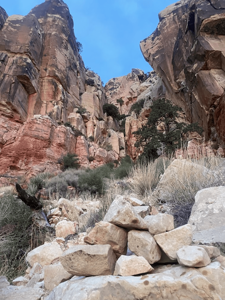
Once in the main gully, follow cairns up, trending left, until you walk fully left up to a new, narrow gully, with another big chockstone to tunnel underneath. Inti Watana is up this gully, easily identifiable by the shiny new glue-ins.
Inti Watana
Inti Watana itself is a very straightforward climb. The bolts on the first two pitches have been replaced with fresh new glue-ins, making the hardest two pitches on the route feel quite safe.
| Pitch | Grade | Type | Protection | Belay / Notes |
|---|---|---|---|---|
| 1 | 5.10a | slab | fully bolted | |
| 2 | 5.10c | slab | fully bolted | crux: trust the layback, stay left |
| 3 | 5.8 | slab | fully bolted | |
| 4 | 5.9 | slab to a crack | bolts, then gear | belay is a good stance, but hardly a “ledge” |
| 5 | 5.7 | cracks | gear | easy to follow the crack system going right from the belay |
| 6 | 5.6 | cracks | gear, then 4(?) bolts | good ledge |
| 7 | 5.9 | “the S crack” | gear | fully hanging belay |
| 8 | 5.9+ | slab | fully bolted | giant bivy ledge |
| 9 | 5.9 | roof to slab | fully bolted | easy to pull on draws to get through the roof. the feet are crumbling, this move will likely be a lot harder in 10 years. short pitch, easily linked with pitch 10 |
| 10 | 5.9 | steep slab | fully bolted | hanging belay |
| 11 | 5.9 | slab | fully bolted | link 11 and 12 |
| 12 | 5.10 | steep slab and slight overhang | fully bolted | ledge at top of route; really fun pitch, incredible exposure |
Transition to Resolution Arete
From the top anchor on Inti, scramble up to the left to get onto the flat top of big, slanted boulders. You could unrope since it’s mostly walking, but we opted to belay each other across to the bivy spot, which is across the flat top, and down to the right, at the base of the main wall.
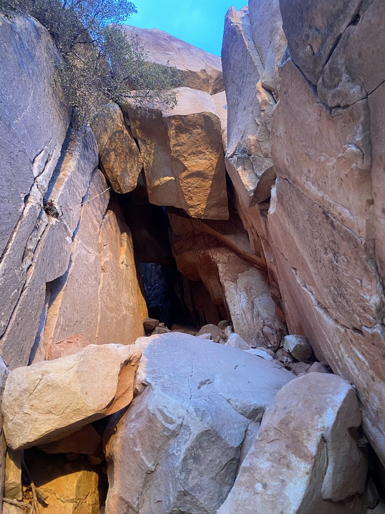
There is a 5.4 short pitch (some parties would stay unroped) up a left-leaning crack on the right side of the wall below the big boulder (this looks like the first half of the pitch 15 topo, but you don’t climb up any offwidths, or overhung 5.9 face moves). Scramble between two boulders and drop down into the gully/area behind, see photo below. I top-rope belayed Ken up, since we were counterbalanced around the rock. From here, turn climbers left and go behind the boulder to reach the start of what looks like the George Bell pitch 18 (50m 3″-5″ crack). There is indeed a second crack on the right that looked harder. This pitch is the offwidth dihedral visible on the left, as soon as you scramble up from the top anchor of Inti.
Upper Resolution Arete
The offwidth dihedral takes a BD #4, and could have taken a second, or a #5, but who wants to carry an offwidth rack up Inti Watana?
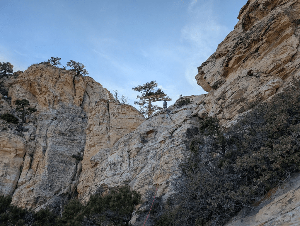
From the top of the dihedral, look left, and you’ll see a catwalk, and up high on the left, a big pine tree. There’s a photo in the mountain project description of the catwalk: maybe 15 meters of flat, varnished, exposed sidewalk heading to the left. From the catwalk, you arrive at a little dirt clearing. Note this catwalk is not the catwalk described in George Bell topo pitch 17. We did not do that catwalk. We think George Bell’s topo implies you climb up the offwidth boulder and do a catwalk traverse from there, but it’s so much easier to just walk underneath that boulder.
From the clearing, the pine tree is up on the left and it’s tempting to head that way, but the easier climbing is certainly up the gully to the right. There’s a mountain project photo of this spot. This was pretty runout 5.8 crack climbing, especially since I didn’t bring the #4 for this pitch. You can run this pitch all the way to the tree, if you want to squat the rope with rope drag at the top, or break it up after the dihedral ends.
From the tree, we coiled half our rope and simul-ed up around to the left. We did not go far down or far around to the left, as the George Bell topo shows, just a step down from the tree and up the slab with loose blocks up and eventually to the right. From here, there’s many options on which little boulder problems you want to climb! We were stressed that we’d accidentally end up on a sub-peak that didn’t connect, but even trending to the right, we ended up easily navigating to the top.
Hike Off
We opted to hike out via Oak Creek. This took us about 4 hours (including a 20 minute nap). It likely took us a little longer navigating around in the dark, than if we were descending before sunset.
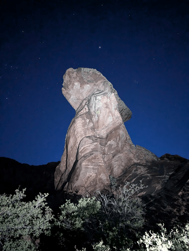
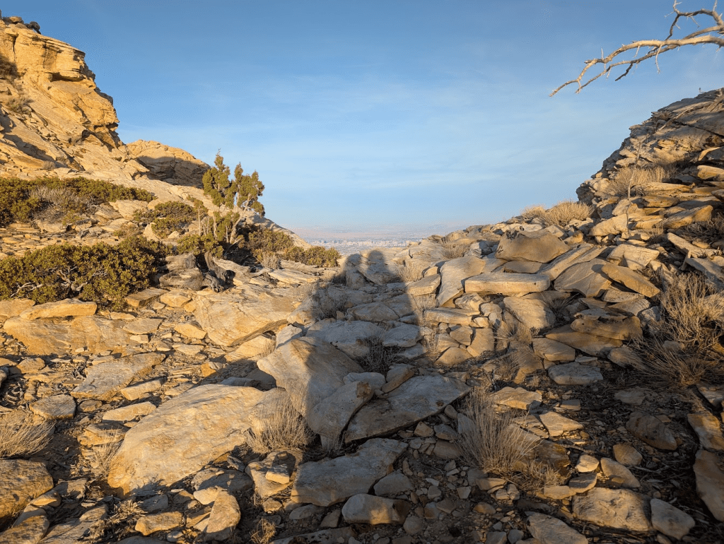
This is the big mushroom rock visible up on the right – marking the start of the descent slabs. There’s a small trail going around it to the right.
We thought we might be cliffed out many (many, many!) times descending the slabs, but each time there was some option: a few downclimbs to the left or right, a handline down a steep slab, etc.
We had a GPX track we were following closely to the top of the gully (since there are many side drainages that turn right and cliff out) and after that it was straightforward to navigate the all the way down the main Wilson gully to the wash.
We opted to hike out past Solar Slab, to the Middle Oak Creek trailhead, since this trail is straight, and less rocky than the road coming in from the South Oak Creek trailhead. Then, we had to walk awhile on the highway. Not sure if this was faster in the end, but it was mentally easier to just walk fast on flat ground. We’ll consider just parking here for a future approach to the Aeolian wall.
Thanks for reading this far! If this post inspired you to get out there, or if you have any questions about the route, leave a comment below or contact me. If you’d like to climb together, you can learn more about me here, and check my availability here.
Subscribe
Follow my blog to have new posts delivered to your inbox.

Leave a reply to 2025: Finding my stride and my limit – Mia Climbs Cancel reply